| |
| These maps have all been carefully scanned, digitally re-projected and enlarged to match the present-day Ordnance Survey Landranger® series. Each Cassini Old Series map is directly comparable with the corresponding Ordnance Survey Landranger® and uses the same sheet number and grid references, so enabling the past and the present to be compared with ease and accuracy. |
| Old Series Edition - 1805 to 1874 |
|
| Revised New Series - 1896 to 1904 |
|
 |
Britain’s 19th-century landscape re-projected and enlarged to match the present-day Ordnance Survey Landrangers®
These maps are based on Britain's Ordnance Survey's One-Inch (‘Old Series’) maps which were first published between 1805 and 1874. All the Old Series maps of England & Wales (123 in all) have now been published.
|
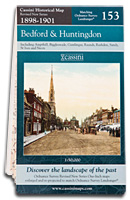 |
Britain’s late-Victorian landscape re-projected and enlarged to match the present-day Ordnance Survey Landrangers®
These maps are taken from Ordnance Survey's Revised New Series (in colour) maps which were first published between 1896 and 1904. All the Revised New Series maps of England & Wales (122 in all) have been published.
|
 |
|
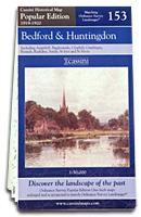
| Popular Edition -
1919 to 1926 |
|
| Past & Present -
1805 to the present |
|
 |
Britain’s inter-war landscape
re-projected and enlarged to match the present-day Ordnance Survey Landrangers®
These maps are taken from Ordnance Survey's Popular Edition maps which were first published between 1919 and 1926. All the Old Series maps of England & Wales (123 in all) have been published.
|
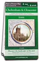 |
Four maps in one – a unique way to discover the landscapes of the past
Each Past & Present map is centred on a city or town and covers an area of 15km x 15km using four Ordnance Survey mapping series to cover four different periods: the mid 19th century, the late 19th century, the1920s and the present-day. Comparing the past with the present has never been easier! |
|
|
|
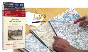 |
Cassini 3-map Box Sets - Three matching Cassini maps from three different periods, designed to appeal to anyone who wants to discover the hidden history of their local landscape.
These maps are taken from Ordnance Survey's Old Series, Revised New Series and Popular Edition maps. Each map in the Box Set has been carefully scanned, digitally re-projected and enlarged to match the present-day Ordnance Survey Landranger® series. The maps are also directly comparable with the corresponding Ordnance Survey Landranger®, so enabling the past and the present to be compared with ease and accuracy.
|
|
|
|
|